Offline Maps, Street View, and Route Navigation in One Android App
If you want a map app that combines route navigation, satellite imagery, street view, and offline tools in one place, GPS Satellite Earth Map View is designed to do exactly that. This Android app focuses on helping users explore places, find routes, and view locations using a mix of live GPS maps, 2D map views, and satellite-style navigation tools. It is built for travelers, drivers, and everyday users who want more than just simple turn-by-turn directions. G5
The app has gained significant traction on Google Play, with millions of downloads, and it markets itself as an all-in-one navigation companion for route planning, world map exploration, and street-level viewing.
What is GPS Satellite Earth Map View?
GPS Satellite Earth Map View is a maps and navigation app from Soft Clicks. Its goal is to combine navigation with visual exploration features such as satellite maps, street views, and live location tools. According to its Google Play listing, the app helps users navigate routes, explore global landmarks, search locations, and use Earth-style maps from their phones.
Key Features
1) Satellite Maps and Earth View
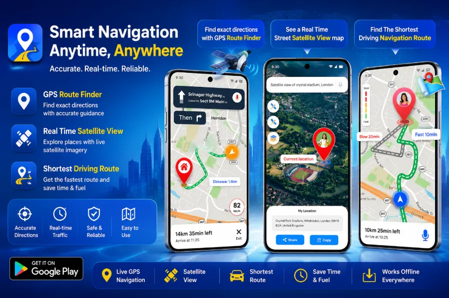
The app’s biggest selling point is its satellite-style world map experience. Users can browse locations using Earth map visuals and view places from a broader aerial perspective instead of relying only on standard road maps. This can be useful for checking unfamiliar areas, spotting landmarks, or previewing destinations before traveling.
2) Route Navigation and Directions
GPS Satellite Earth Map View also includes route guidance features for everyday navigation. The app is positioned as a route-finding tool that helps users move from one place to another using GPS maps and navigation tools. The Play Store description highlights route assistance and destination guidance as a core part of the app.
3) Street View Support
Another major feature is Street View-style location viewing. This gives users a more detailed visual understanding of certain places and roads, which can be helpful when checking a destination before arrival or exploring surrounding areas.
4) Offline Utility
User feedback and third-party app listings indicate that offline maps are one of the app’s useful features, especially for people traveling in areas with weak internet access. While the exact offline capabilities may vary by feature, the app appears to be designed to remain helpful even when connectivity is limited.
5) Place Search and Nearby Discovery
The app also supports location search and exploration features, helping users find destinations and nearby places. Reviews referenced on third-party listings mention searching for hospitals, restaurants, and other nearby points of interest.
User Experience
From the available information, GPS Satellite Earth Map View aims to be visually rich and beginner-friendly rather than highly professional or technical. The app tries to blend exploration features with practical navigation, which may appeal to users who enjoy seeing places in satellite view while still needing route guidance. Its recent versions also appear to focus on interface improvements and crash fixes.
Pros
-
Combines satellite view, Earth maps, and navigation in one app
-
Includes route guidance tools
-
Street View-style exploration features
-
Useful for visual destination previewing
-
Large download base on Google Play
-
Appears to support offline use for some scenarios
Cons
-
The app category is crowded with many similar navigation tools, so feature quality may vary from phone to phone
-
Some “live Earth” or “street view” wording in map apps can be broader marketing language rather than the same level of coverage as Google Maps or Google Earth
-
Offline functionality details are not always clearly explained in third-party sources
-
Apps in this category often include ads and can feel feature-heavy if you only want simple navigation
Final Verdict
GPS Satellite Earth Map View looks like a solid option for Android users who want an all-in-one map app with a stronger focus on satellite visuals, street view exploration, and route navigation rather than basic directions alone. It appears most useful for users who like to preview locations visually, explore world maps, and keep an extra navigation app on hand for travel or general route planning.
If your main goal is simple, highly accurate everyday navigation, apps like Google Maps may still be the safer default.
But if you want a more visual map experience with Earth-style exploration and extra navigation tools in one place, GPS Satellite Earth Map View is worth a look.